Wednesday, June 30, 2010

Michinmahuida

Michinmahuida is a glaciated stratovolcano located in Los Lagos Region of Chile. It situated about 15 km east of Chaiten volcano, and was extensively covered in ash during the 2008 eruption of Chaiten. The Michinmahuida lies above the regional Liquine-Ofqui Fault zone, and the ice-covered massif towers over the south portion of Pumalín Park. The Michinmahuida volcano is also known as Michinmávida or Michimahuida.

Two major explosive eruptions of the Michimahuida during the Holocene produced tephra deposits extending to the east. An eruption from Minchinmávida was reported in 1742. Darwin observed the volcano in activity in 1834 on his renowned voyage that took him to the Galápagos Islands. The latest known eruption of basaltic-to-andesitic Minchinmávida, from February to March 1835, produced a lava flow from a flank crater and lahars that reached the coast at Punta Chana.

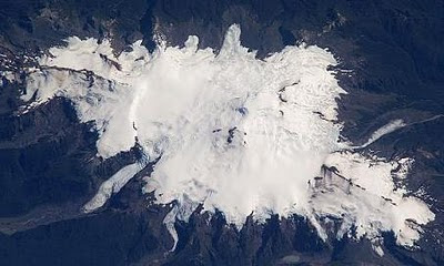
Aerial View of Michinmahuida

Tuesday, June 29, 2010

Isluga Volcano

Isluga is a 18,209ft-high stratovolcano which lies in Colchane, 7 km west of the Chile/Bolivia border and at the west end of a group of volcanoes lined up in an east-west direction, which also includes the volcanoes Cabaray and Tata Sabaya. Isluga has an elongated summit area and lies within the borders of Volcán Isluga National Park. Isluga is a large elongated volcanic complex, which currently shows fumarolic activity. On top of it summit there is a a 400 m wide crater. Major eruptions occurred in 1868, 1869, 1877, and 1878. Minor eruptions occurred in 1863 and 1885. Sulphur is deposited at the volcano base. Some activity was reported in 1913.


Satellite Photo of Isluga Volcano

Monday, June 28, 2010

Nevado del Huila

Lying in Cordillera Central mountain range, in Huila Department, the Nevado del Huila is the highest active volcano in Colombia. It is 5,365 meters (17,602 ft) high and had been dormant for more than 500 years until it showed heavy signs of activity in 2007 and 2008. As of February 20, 2007, there were more than 7000 "minor" seismic events, and a high state of alert was in place for the departments of Cauca, Huila, Caldas and Valle del Cauca.

The Nevado del Huila volcano erupted twice in April 2007, once in April 2008 and again in November 2008. Any eruption would affect the small villages around the volcano, mostly Paez, Cauca, where their habitants still have in memory the eruption of the Nevado del Ruiz volcano and the destruction of Armero. The high point of the Nevado del Huila complex is Pico Central. Two glacier-free lava domes lie at the southern end of the complex.

Saturday, June 26, 2010

Nevado del Tolima

Nevado del Tolima is a 5,225-meter-high stratovolcano which is situated in the Tolima Department, Colombia. It lies to the south of Nevado del Ruiz volcano.

The steep-sided, glacier-clad Nevado del Tolima volcano contrasts with the broad profile of Nevado del Ruiz volcano to the north. The andesitic-dacitic younger Tolima volcano formed during the past 40,000 years, rising above and largely obscuring a 3-km-wide late-Pleistocene caldera. The summit consists of a cluster of late-Pleistocene to Holocene lava domes that were associated with thick block-lava flows on the northern and eastern flanks and extensive pyroclastic-flow deposits.

The Nevado del Tolima summit has a funnel-shaped crater 200–300 m deep. Holocene activity has included explosive eruptions ranging in size from moderate to plinian. The last major eruption took place about 3600 years ago. Lava dome growth has produced block-and-ash flows that traveled primarily to the NE and SE. Minor explosive eruptions have been recorded from Tolima in the 19th and 20th centuries.

Friday, June 25, 2010

Aucanquilcha

Aucanquilcha is a massive stratovolcano located in Antofagasta Region of northern Chile, just west of the border with Bolivia. It is 6,176 m (20,262 ft) high and comprises a number of overlapping cones along a 10 km (6 mi) long ridge that forms the summit. There is weak, episodic fumarolic activity and voluminous sulfur deposits in the summit region. During the Pleistocene ice ages, an extensive ice cap with an area over 45 km² (17 mi²) mantled the upper slopes, extending down as low as 4,600 m (15,000 ft) and leaving large moraines.

A sulfur mine, owned by the Carrasco family, was located near the summit of Aucanquilcha, which was the world's highest mine until it closed in the 1990s, and it was serviced by perhaps the highest driveable road in the world, but this road is no longer usable by vehicles. The highest permanent human habitation was a miners' barracks at about 5,500 m (18,000 ft). Mining originally began on the volcano in 1913, initially using llamas as pack animals to carry down the sulfur. An aerial cable system extending for 22 km (14 mi) was completed in 1935, to lower the sulfur in buckets. Eventually this was replaced by the road which switchbacked up to the summit and was capable of supporting 20-ton mining trucks.

Thursday, June 24, 2010

Protolith

Protolith is the original, sedimentary rock from which a metamorphic rock is formed. It refers to the precursor lithology of a metamorphic rock. For example, the protolith of a slate is a shale or mudstone. Metamorphic rocks can be derived from any other rock and thus have a wide variety of protoliths. Identifying a protolith is a major aim of metamorphic geology. Sedimentary rocks have no protolith because they are made of sediment. Igneous rocks have no protolith because they form from magma.

Wednesday, June 23, 2010

Acotango Volcano

Acotango is stratovolcano lying on the border of Chile and Bolivia. It is 19,856 ft high and is the central and highest of a group of stratovolcanoes in the area. The group is known as Nevados de Quimsachata and consists of Acotango, Humarata (18,799 ft) to its north and Cerro Capurata (19,652 ft) on its south. This group of volcano lies in a north-south direction. Although the Acotango volcano is heavily eroded, a lava flow on its northern flank is morphologically young, suggesting Acotango was active in the Holocene.


Tuesday, June 22, 2010

Sheet Intrusion

A sheet intrusion is a mass of molten (when forming) or solidified (after formation) igneous rock that takes advantage of a pre-existing linear feature in a host rock, such as a long rupture or fault. Sheet intrusions are among the most extensive igneous features on Earth, in the form as dikes, dike swarms, laccoliths, and sills.

Monday, June 21, 2010

Laccolith

A laccolith is a sheet intrusion that has been injected between two layers of sedimentary rock. It is a small area that broke away from the main area of magma but did not have the pressure to break through the surface. In other words, a laccolith is a small magma chamber which has formed near the surface. The pressure of the magma is high enough that the overlying strata are forced upward, giving the laccolith a dome or mushroom-like form with a generally planar base.

Laccoliths are formed by relatively viscous magmas at relatively shallow depths, such as those that crystallize to diorite, granodiorite, and granite. Cooling underground takes place slowly, giving time for larger crystals to form in the cooling magma. The surface rock above laccoliths often erodes away completely, leaving the core mound of igneous rock. The term was first applied as laccolite by Grove Karl Gilbert after his study of intrusions of diorite in the Henry Mountains of Utah in about 1875.

At places, such as in the Henry Mountains and other isolated mountain ranges of the Colorado Plateau, some intrusions demonstrably have shapes of laccoliths. The small Barber Hill syenite-stock laccolith in Charlotte, Vermont USA, has several volcanic trachyte dikes associated with it. Molybdenite is also visible in outcrops on this exposed laccolith.

Saturday, June 19, 2010

Lopolith

A lopolith is a large igneous intrusion which is lenticular in shape with a depressed central region. In other words, it is a mass of igneous rock similar to a laccolith but concave downward rather than upward. Lopoliths are generally concordant with the intruded strata with dike or funnel-shaped feeder bodies below the body. The term was first defined and used by Frank Fitch Grout during the early 1900s in describing the Duluth gabbro complex in northern Minnesota and adjacent Ontario.

Lopoliths typically consist of large layered intrusions that range in age from Archean to Eocene. Examples include the Duluth gabbro, the Sudbury Igneous Complex of Ontario, the Bushveld igneous complex of South Africa, the Skaergaard complex of Greenland and the Humboldt lopolith of Nevada. The Sudbury and Bushveld occurrences have been attributed to impact events and associated crustal melting.

Friday, June 18, 2010

Compaction

In geology, compaction refers to the process by which a sediment progressively loses its porosity due to the effects of loading. This forms part of the process of lithification. When a layer of sediment is originally deposited, it contains an open framework of particles with the pore space being usually filled with water. As more sediment is deposited above the layer, the effect of the increased loading is to increase the particle-to-particle stresses resulting in porosity reduction primarily through a more efficient packing of the particles and to a lesser extent through elastic compression and pressure solution.

The initial porosity of a sediment depends on its lithology. Mudstones start with porosities of >60%, sandstones typically ~40% and carbonates sometimes as high as 70%. Results from hydrocarbon exploration wells show clear porosity reduction trends with depth. In sediments compacted under self-weight, especially in sedimentary basins,the porosity profiles often show an exponential decrease, called Athy's law as first shown by Athy in 1930. A mathematical analytical solution was obtained by Fowler and Yang to show the theoretical basis for Athy's law. This behaviour can be easily observed in experiments and used as a good approximation to many real data.

Thursday, June 17, 2010

Irruputuncu Volcano

Irruputuncu is a stratovolcano which straddles the border between Chile and Bolivia. It is a relatively small peak, lying within the collapse scarp of a debris avalanche from earlier in the Holocene. Succeeding eruptions filled much of this scarp and produced thick, viscous lava flows the western flank. Irruputuncu volcano is 5,163 m high and had two craters on top, with the one to the south displaying fumaroles. The first eruption in recorded history occurred in 1995 in the form of a phreatic eruption.


Wednesday, June 16, 2010

Shale Rock

Shale is a type of sedimentary rock which was formed from clay that was compacted together by high pressure. Shale is characterized by breaks along thin laminae or parallel layering or bedding less than one centimeter in thickness, called fissility. It exhibits varying degrees of fissility breaking into thin layers, often splintery and usually parallel to the otherwise indistinguishable bedding plane because of parallel orientation of clay mineral flakes. Shale is used to make bricks and other material that is fired in a kiln.

The process in the rock cycle which gives origin to shale is compaction. The fine particles that compose shale can remain suspended in water long after the larger and denser particles of sand have deposited. Shales are typically deposited in very slow moving water and are often found in lakes and lagoonal deposits, in river deltas, on floodplains and offshore from beach sands. They can also be deposited on the continental shelf, in relatively deep, quiet water. Black shales are dark, as a result of being especially rich in unoxidized carbon. Common in some Paleozoic and Mesozoic strata, black shales were deposited in anoxic, reducing environments, such as in stagnant water columns.

Tuesday, June 15, 2010

Arintica Volcano

Arintica is a stratovolcano lies in Arica and Parinacota Region, in norther Chile, on the border with Bolivia. It is situated north of the Salar de Surire. On the south and west flanks of Arintica volcano there are large active rock glaciers that have been misinterpreted in the past as lava flows. Arintica is part of a larger volcanic system with Cerro Puquintica to the east and Cerro Calajalata to the west. On its southern flanks, there are well developed moraines.


Monday, June 14, 2010

Gneiss Rock

Gneiss is a foliated metamorphic rock which is widely distributed around the world. It is formed by high-grade regional metamorphic processes from pre-existing formations that were originally sedimentary rocks. Gneissic rocks are usually medium- to coarse-foliated and largely recrystallized but do not carry large quantities of micas, chlorite or other platy minerals. Gneisses that are metamorphosed igneous rocks or their equivalent are termed granite gneisses, diorite gneisses, etc. Depending on their composition, they may also be called garnet gneiss, biotite gneiss, or albite gneiss.

Found over extensive metamorphic terrain, gneiss is a coarse-grained banded crystalline rock. Orthogneiss is formed by the metamorphism of igneous rocks; paragneiss results from the metamorphism of original sedimentary rocks. Pencil gneiss contains rod-shaped individual minerals or segregations of minerals, and augen gneiss contains large lenticular mineral grains or mineral aggregates having the appearance of eyes scattered through the rock.

Sunday, June 13, 2010

Metamorphic Rock

A metamorphic rock is a sedimentary rock which has been altered and hardened by exposure to high temperatures and pressure. The rock precursor that is transformed into a metamorphic rock is called protolith. Metamorphic rock is the result of the transformation of this existing rock type, the protolith, in a process called metamorphism, which means "change in form". The protolith is then subjected to heat and pressure, temperatures greater than 150 to 200 °C and pressures of 1500 bars, causing profound physical and/or chemical change. The protolith may be sedimentary rock or another older metamorphic rock.

Metamorphic rocks make up a large part of the Earth's crust and are classified by texture and by chemical and mineral assemblage (metamorphic facies). They may be formed simply by being deep beneath the Earth's surface, subjected to high temperatures and the great pressure of the rock layers above it. They can form from tectonic processes such as continental collisions, which cause horizontal pressure, friction and distortion. They are also formed when rock is heated up by the intrusion of hot molten rock called magma from the Earth's interior. The study of metamorphic rocks provides us with information about the temperatures and pressures that occur at great depths within the Earth's crust. Some examples of metamorphic rocks are gneiss, slate, marble, schist, and quartzite.

Gneiss rock

Saturday, June 12, 2010

Tonalite

Tonalite is a plutonic rock, of felsic composition, with phaneritic texture. Feldspar is present as plagioclase (typically oligoclase or andesine) with 10% or less alkali feldspar. Quartz is present as more than 20% of the rock. Amphiboles and pyroxenes are common accessory minerals. Tonalite is sometimes used as a synonym for quartz diorite. Nevetheless the current IUGS classification defines tonalite as having greater than 20% quartz and quartz diorite with from 5 to 20% quartz.

The name tonalite is derived from the type locality of tonalites, adjacent to the Tonale Line, a major structural lineament and mountain pass, Tonale Pass, in the Italian and Austrian Alps.

Trondhjemite is an orthoclase-deficient variety of tonalite with minor biotite as the only mafic mineral, named after Norway's third largest city, Trondheim.

Thursday, June 10, 2010

Monzonite

Monzonite is an intermediate igneous intrusive rock composed of approximately equal amounts of sodic to intermediate plagioclase and orthoclase feldspars with minor amounts of hornblende, biotite and other minerals. Quartz is a minor constituent of monzonite. When it contains more than 10% of quartz, the rock is then called a quartz monzonite. If monzonite has more orthoclase or potassium feldspar it grades into a syenite. With an increase of calcic plagioclase and mafic minerals the rock type becomes a diorite. The volcanic equivalent is the latite.

Monzonite

Wednesday, June 9, 2010

Skjaldbreidur Shield Volcano

Skjaldbreidur is an Icelandic shield volcano which was formed in a protracted eruption that occurred roughly 9,000 years ago. The extensive lava fields which were produced by this eruption, flowed southwards, and formed the basin of pingvallavatn, Iceland's largest lake, and pingvellir, the "Parliament Plains" where the Icelandic national assembly, the Alping was founded in the year 930.

The Skjaldbreidur volcano rises up to 1,060 meters, and its crater measures roughly 300 meters in diameter. Straddling the Mid-Atlantic ridge, the lava fields from Skjaldbreidur have been torn and twisted over the millennia, forming a multitude of fissures and rifts inside the pingvellir National Park, the best known of which are Almannagja, Hrafnagja and Flosagja.

Tuesday, June 8, 2010

Mayon Volcano

Mayon volcano, also known as Mount Mayon, is an active stratovolcano in the province of Albay, on the island of Luzon, in the Philippines. Rising to 2,462 m above the Albay Gulf, it is one of the most beautifully symmetrical volcano in the world. The current cone was formed through pyroclastic and lava flows from past eruptions. Mayon volcano is the most active volcano in the Philippines, having erupted over 49 times in the past 400 years.

The Mayon volcano historical eruptions date back to 1616, ranging from strombolian to basaltic plinian, with cyclical activity beginning with basaltic eruptions, followed by longer term andesitic lava flows. Eruptions occur predominately from the central conduit and have also produced lava flows that travel far down the flanks. Pyroclastic flows and mudflows have commonly swept down many of the approximately 40 ravines that radiate from the summit and have often devastated populated lowland areas.

Monday, June 7, 2010

Extrusive Rocks

Extrusive rocks are igneous volcanic rocks which formed when hot magma extruded from inside the Earth (flew out) onto the surface as lava or explodes violently into the atmosphere to fall back as pyroclastics or tuff, and then solidified as rocks when this magma cooled off. Extrusive rocks are opposed to intrusive or plutonic rocks, in which magma does not reach the surface.

The main effect of extrusion is that the magma can cool much more quickly in the open air or under seawater, and there is little time for the growth of crystals. Often, a residual portion of the matrix fails to crystallize at all, instead becoming an interstitial natural glass or obsidian. If the magma contains abundant volatile components which are released as free gas, then it may cool with large or small vesicles (bubble-shaped cavities) such as in pumice, scoria, or vesicular basalt.

Sunday, June 6, 2010

Mount Meager

Formerly known as Cathedral Mountain, Mount Meager is an eight-vent volcano which is situated about 93 miles north of the city of Vancouver and 40 miles northwest of Pemberton, British Columbia, Canada. It is a potentially active and the most unstable volcanic massif in Canada. The most recent eruption of Mount Meager occurred about 2,400 years ago from a vent on the northeast side of Plinth Peak. This eruption produced a plume of ash, pyroclastic flows, and a short lava flow. This volcano complex consisting of eight vents dates back to the Pliocene Epoch. Mount Meager was named after J.B. Meager, who owned timber licenses on Meager Creek.

The Mount Meager and the surrounding area are part of Pacific Ranges of the Coast Mountains and Garibaldi Volcanic Belt which is a northern extension of the Cascade Volcanic Arc in the United States. Mount Meager is said to be the most promising site for geothermal power development in British Columbia, and the east flank of the volcano is staked out by BC Hydro for test drilling purposes. Plans surface now and then for a "boutique" hotel and ski resort based around the two clusters of hot springs.

The volcano lies above the west flank of the Lillooet River and just south of the Lillooet Icecap. With at least eight vents, Mount Meager is generally considered the northernmost major volcanic center of the Cascade Volcanic Arc and Garibaldi Volcanic Belt. However, a few isolated volcanic centers northwest of Mount Meager, such as Mount Silverthrone, which is a circular 12-mile wide, deeply dissected caldera complex, may also be the product of Cascadia subduction, but geologic investigations have been very limited in this region.

Saturday, June 5, 2010

Plinth Peak

Plinth Peak is the highest satellite cone of Mount Meager, and one of four overlapping volcanic cones which together form the northermost volcanic complex in the Cascade Volcanic Arc and the Garibaldi Volcanic Belt. Lying in the province of British Columbia, Canada, Plinth Peak is a stratovolcano, which last erupted about 2,350 years ago. Its oldest rocks date back to the Holocene, about 12,000 years ago. Plinth is 8,780 ft high and was first climbed in 1931 by a party who approached via horse from Pemberton.

Plinth Peak is the most recent volcanic peak of Mount Meager to erupt, and the source for the most recent explosive eruption in the Garibaldi Volcanic Belt. The eruption was similar to the 1980 eruption of Mount St. Helens, sending ash as far as Edmonton in southern Alberta and forming Keyhole Falls. The steep north face of the peak is the remnant of the inner crater wall, which was destroyed by the lateral blast of the eruption.

Friday, June 4, 2010

Volcanism in Canada

Although the country's volcanic activity dates back to the Precambrian period, volcanism in Canada continues its activity in Western and Northern Canada, forming part of an encircling chain of volcanoes and frequent earthquakes around the Pacific Ocean called the Pacific Ring of Fire. But because volcanoes in Western and Northern Canada are in remote rugged areas and the level of volcanic activity is less frequent than with other volcanoes around the Pacific Ocean, Canada is commonly thought to occupy a gap in the Pacific Ring of Fire between the volcanoes of western United States to the south and the Aleutian volcanoes of Alaska to the north. However, the mountainous landscape of Western and Northern Canada includes more than 100 volcanoes that have been active during the past two million years and have claimed many lives. Volcanic activity has been responsible for many of Canada's geological and geographical features and mineralization, including the nucleus of North America called the Canadian Shield.

Volcanism in Canada has produced lava flows, lava plateaus, lava domes, cinder cones, stratovolcanoes, shield volcanoes, submarine volcanoes, calderas, diatremes, and maars, along with examples of more less common volcanic forms such as tuyas and subglacial mounds. It has a very complex volcanological history spanning from the Precambrian period at least 3.11 billion years ago when this part of the North American continent began to form.

Volcanism has led to the formation of hundreds of volcanic areas and extensive lava formations across Canada, indicating volcanism played a major role in shaping its surface. The country's different volcano and lava types originate from different tectonic settings and types of volcanic eruptions, ranging from passive lava eruptions to violent explosive eruptions. Canada has a rich record of very large volumes of magmatic rock called large igneous provinces. They are represented by deep-level plumbing systems consisting of giant dike swarms, sill provinces and layered intrusions. The most capable large igneous provinces in Canada are Archean (3,800–2,500 million years ago) age greenstone belts containing a rare volcanic rock called komatiite.

Eve Cone in Canada

Thursday, June 3, 2010

Lava Butte

Lava Butte is a cinder cone which is situated west of US Highway 97 between the towns of Bend and Sunriver, Oregon, USA. It is 500 ft high and has a crater 180 feet deep, measured from the high point on the rim. Lava Butte is part of a system of small cinder cones on the northwest flank of Newberry Volcano, a massive shield volcano which rises to the southeast. Lava Butte is part of the Newberry National Volcanic Monument. In 1977, Lava Butte last eruption was dated at 6150 radiocarbon years old, which is equivalent to 7000 calendar years.

The eruption began with a fissure spewing hot cinders to form the cone. In the next phase, a river of hot basalt flowed from the base of the small volcano to cover a large area to the west with a lava flow which remains largely free of vegetation. The lava flows reached the Deschutes River about 2.5 miles (4.0 km) to the west of the cone, burying its former channel under over 100 feet (30 m) of lava and damming the river to form a lake, known as Lake Benham. The river eventually overflowed the lava dam and eroded down into it, draining the lake and forming Benham Falls.

Lava Butte is a major point of interest in Newberry National Volcanic Monument. The summit of Lava Butte is usually accessible by car from mid-May to late-October. The road can be hiked during the off season. A trail with interpretive signs circles the crater.

Wednesday, June 2, 2010

Antuco Volcano

Antuco Volcano is an active stratovolcano lying near Sierra Velluda, in the Bio-Bio Region of Chile. It is 9,775 ft high and is situated on the shore of Laguna del Laja. The last known eruption occurred in 1869.

The Antuco volcano geological construction was followed by edifice failure at the beginning of the Holocene that produced a large debris avalanche which traveled down the Río Laja to the west and left a large 5-km-wide horseshoe-shaped caldera breached to the west. The steep-sided modern basaltic-to-andesitic cone of has grown 1000 m since then; flank fissures and cones have also been active. Moderate explosive eruptions were recorded in the 18th and 19th centuries from both summit and flank vents, and historical lava flows have traveled into the Río Laja drainage.

Tuesday, June 1, 2010

La Soufriere

La Soufriere is a stratovolcano on the island of Saint Vincent in the Windward Islands of the Caribbean. It is the highest peak on Saint Vincent, 4,049 ft high. La Soufriere is the island's northernmost and youngest volcano and is also known as Soufriere Saint Vincent. It lies in the northernmost third of the island and is considered to be the only volcano that is likely to erupt in the future. The main crater of the Soufrière is about 1.6 km in diameter and is 300-600 m in depth.

La Soufriere violently erupted in 1718, 1812, 1902, 1971, and 1979. The eruption of May 7, 1902, just hours before the eruption of Mount Pelee on Martinique, killed 1,680 people. The last recorded eruption was in April 1979; due to advance warning there were no casualties.