Monday, May 31, 2010

Nevado del Ruiz

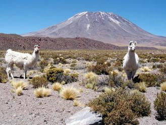
Nevado del Ruiz is an active stratovolcano which is found the Colombian Andean Volcanic Belt. It lies about 129 kilometers west of Bogota in the Tolima Department of Colombia. It is made up of many layers of lava alternating hardened volcanic ash and other pyroclastic rocks. Nevado del Ruiz has been active for about two million years, since the early Pleistocene or late Pliocene epoch, with three major eruptive periods. The current volcanic cone formed during the "present" eruptive period, which began 150 thousand years ago.

Nevado del Ruiz generates Plinian eruptions, which produce swift-moving currents of hot gas and rock called pyroclastic flows. These eruptions often cause massive lahars (mud and debris flows), which pose a threat to human life and the environment. In 1595, the Nevado del Ruiz erupted and a lahar swept down the valleys of the River Guali and the River Lagunillas, killing 636 people. In 1845, an immense lahar flooded the upper valley of the River Lagunillas, killing over 1000 people. It continued for 70 kilometers downstream before spreading across a plain in the lower valley floor. The young village of Armero was built directly on top of the 1845 mudflow deposit. Over the ensuing years, Armero grew into a vibrant town with over 27,000 residents.

On November 13, 1985, a small eruption produced an enormous lahar that buried and desolated the town of Armero in Tolima Department, causing an estimated 23,000 deaths. This event later became known as the Armero tragedy—the deadliest lahar in recorded history. Similar but less deadly incidents occurred in 1595 and 1845, consisting of a small explosive eruption followed by a large lahar.

The Nevado del Ruiz is part of the Ruiz–Tolima volcanic massif (or Cordillera Central), a group of five ice-capped volcanoes which includes the Tolima, Santa Isabel, Quindio and Machin. The volcano is part of Los Nevados National Park, which also contains several other volcanoes. The summit of Nevado del Ruiz is covered by large glaciers, although these have retreated significantly since 1985 because of atmospheric warming. The volcano continues to pose a threat to the nearby towns and villages, and it is estimated that up to 500,000 people could be at risk from lahars.

Satellite photograph of the Nevado del Ruiz

1985 Eruption of Nevado del Ruiz (Video)

Saturday, May 29, 2010

Mount Pelee

Mount Pelee is an active stratovolcano located on the northern tip of the French island of Martinique in the Lesser Antilles island arc of the Caribbean. It is among the deadliest stratovolcanoes on Earth. Its volcanic cone is composed of layers of volcanic ash and hardened lava.

Mount Pelee is the result of a subduction zone which formed the Lesser Antilles island arc, a curved chain of volcanoes approximately 850 kilometers in length, between Puerto Rico and Venezuela, where the Caribbean Plate meets Atlantic Oceanic crust belonging to the South American Plate. Other volcanoes in the island arc are also active, including Saint Vincent's La Soufrière, Guadeloupe's Soufriere volcano, Montserrat's Soufrière Hills, and the submarine volcano Kick-'em-Jenny.

Geological History of Mount Pelee

In the geological evolution of Mount Pelee volcano, three different phases have been identified: initial, intermediate, and modern. In an initial phase, called the Paleo-Pelee stage, Mount Pelee was a common stratovolcano. The cone of Paleo-Pelee was composed of many layers of lava flows and fragmented volcanic debris. Remains of the Paleo-Pelee cone are still visible at the northern view at the volcano today.

A second stage, now called the intermediate phase, started around 100,000 years ago, after a long period of quiescence. This stage is grouped by the formation of the Morne Macouba lava dome, then later on, the Morne Macouba caldera. During the intermediate phase, there were several eruptions which produced pyroclastic flows like those that destroyed Saint-Pierre in the 1902 eruption. Around 25,000 years ago, a large Southwest sector collapse occurred, forming a landslide. This event is similar to the eruption of Mount Saint Helens in 1980.

The modern stage of the evolution of Mount Pelée has created most of the current cone, with deposits of pumice and the results of past pyroclastic flows. More than 30 eruptions have been identified during the last 5,000 years of the volcano's activity.

Eruption of Mount Pelee

The Mount Pelee is famous for its eruption in 1902 and the destruction that resulted, now dubbed the worst volcanic disaster of the 20th century. The eruption killed about 30,121 people. Most deaths came from the city of Saint-Pierre, at that time the largest city in Martinique, due to its pyroclastic flows. Before the tragic 1902 eruption, as early as the summer of 1900, signs of increased fumarole activity had been present in the Étang Sec crater near the summit.

Relatively minor phreatic eruptions which had occurred in 1792 and 1851 were evidence that the volcano was active and potentially dangerous. Local natives, the Carib people, knew it as "fire mountain" from previous eruptions in ancient times.

Mount Pelee began its eruptions on April 23, 1902. In early April, excursionists noted the appearance of sulfurous vapors emitting from fumaroles near the mountaintop. This was not regarded as important, as fumaroles had been appearing and disappearing in the past. Nevertheless, on April 23, the mountain caused a light rain of cinders on its southern and western side, together with sharp underground shocks. At 11:30 p.m. on May 2, the mountain produced loud explosions, earthquakes, and a massive pillar of dense black smoke. On Saturday, May 3, the wind blew the ash cloud northwards, alleviating the situation in Saint-Pierre.

On Monday, May 5, the mountain apparently calmed down somewhat; however, at about 1 PM, the sea suddenly receded about 100 metres (330 ft) and then rushed back, flooding parts of the city, and a large cloud of smoke appeared westwards of the mountain. One wall of the Étang Sec crater collapsed and propelled a mass of boiling water and mud, or lahar, into Blanche River, flooding the Guérin sugar works and burying about 150 victims under 60 metres (200 ft) to 90 metres (300 ft) of mud.

On Wednesday, May 7, at around 4 AM, the mountain stepped up its activity; the clouds of ash caused numerous bolts of volcanic lightning around the mountaintop, and both the craters glowed reddish orange into the night. Through the day, people were leaving the city, but more people from the countryside were attempting to find refuge in the city, which increased its population by several thousand.

The main volcanic eruption of Mount Pelee occurred on May 8, 1902, Ascension Day. The horizontal pyroclastic cloud hugged the ground and rushed down towards the city of Saint-Pierre, appearing black and heavy, glowing hot from the inside. It consisted of superheated steam and volcanic gases and dust, with temperatures exceeding 1,075 °C (1,967 °F). In under a minute it reached and covered the entire city, instantly igniting everything flammable with which it came in contact.

Pyroclastic flows completely destroyed St. Pierre, Martinique, a town of 30,000 people, following the eruption of Mont Pelee in 1902. The eruption left only two survivors in the direct path of the volcano: Louis-Auguste Cyparis survived because he was in a poorly ventilated, dungeon-like jail cell; Léon Compère-Léandre, living on the edge of the city, escaped with severe burns. The event marked the only major volcanic disaster in the history of France and its overseas territories.

Friday, May 28, 2010

Pluton

A pluton, or plutonic rock, is an intrusive igneous rock body that crystallized from magma slowly cooling below the surface of the Earth. Plutonic rock is igneous rock formed beneath the surface of the earth by consolidation of magma. Yosemite National Park's Half Dome, in California, is a pluton that became exposed after it formed beneath the Earth.

Plutons include batholiths, dikes, sills, laccoliths, lopoliths, and other igneous bodies. In practice, pluton usually refers to a distinctive mass of igneous rock, typically kilometers in dimension, without a tabular shape like those of dikes and sills. Batholiths commonly are aggregations of plutons. The most common rock types in plutons are granite, granodiorite, tonalite, monzonite, and quartz diorite. The term granitoid is used for a general, light colored, coarse-grained igneous rock in which a proper, or more specific name, is not known. Use of granitoid should be restricted to the field wherever possible.

The term originated from Pluto, the ancient Roman god of the underworld. The use of the name and concept goes back to the beginnings of the science of geology in the late 1700s and the then hotly debated theories of Plutonism (or Vulcanism), and Neptunism regarding the origin of basalt.

Thursday, May 27, 2010

Jorullo

El Jorullo is a cinder cone volcano in Michoacán, central Mexico, on the southwest slope of the central plateau, 33 miles (53 kilometers) southeast of Uruapan. Jorullo has four smaller cinder cones which have grown from it. The vents of Jorullo are aligned in a northeast to southwest direction. Lava from these vents cover nine square km around the volcano.

El Jorullo is one of two known volcanoes to have developed in Mexico in recent history. The second, born about 183 years later, was named Parícutin after a nearby village that it eventually destroyed. Parícutin is about 50 miles (80 km) northwest of this volcano. El Jorullo originated on September 29, 1759. Earthquakes occurred prior to this first day of eruption. Once the volcano started erupting, it continued for 15 years until in 1774. El Jorullo didn’t develop on a corn field like Parícutin did, but it did destroy what had been a rich agricultural area. It grew approximately 820 feet from the ground in the first six weeks.

The eruptions of El Jorullo were phreatic and phreatomagmatic. They covered the area with sticky mud flows, water flows and ash falls. All but the youngest lava flows were covered by this ash fall. Later eruptions were magmatic with neither mud nor water flows. This 15 year eruption was the only one Jorullo ever had, and was the longest cinder cone eruption known.

Wednesday, May 26, 2010

Kostal Cone Volcano

Kostal Cone is a young cinder cone volcano which is situated at the eastern end of Kostal Lake in the Shuswap Highland, British Columbia, Canada. With an elevation of 1,440 m (4,724 ft), Kostal Cone is one of the lowest volcanoes in the Wells Gray-Clearwater volcanic field. The cone and much of the surrounding area are protected within Wells Gray Provincial Park.

Kostal Cone is made of fragmented and solidified lava called cinder and its summit contains a bowl-shaped crater. Kostal's cinders were ejected by lava fountain eruptions and accumulated around the volcano's vent in the shape of a cone when they fell back around its surroundings. Lava flows from Kostal's 400 BP eruption are basaltic in composition and forms a lava bed. This lava bed dams the southern end of McDougall Lake and is just one of the examples of volcanic activity that have occurred in the Wells Gray-Clearwater volcanic field since the last glacial period; others include the "Dragon's Tongue" lava flow from Dragon Cone just north of Kostal Cone.

There has been activity at this site as recently as 7,600 years ago, though more likely less than 1,000 years ago. Kostal Cone is too young for the commonly used potassium-argon dating technique (usable on specimens over 100,000 years old), and no charred organic material for radiocarbon dating has been found. However, the uneroded structure of the cone with the existence of trees on its flanks and summit have it an area for dendrochronology studies, which reveals the growth of tree-ring patterns. Tree-ring dating has revealed an age of 400 years for Kostal Cone, making it the youngest volcano in the Wells Gray-Clearwater volcanic field and one of the youngest volcanoes in Canada.

Monday, May 24, 2010

Regolith

Regolith is a layer of loose, heterogeneous material covering solid rock. It includes dust, soil, broken rock, and other related materials and is present on Earth, the Moon, some asteroids, and other planets. Regolith can vary from being essentially absent to hundreds of metres in thickness. Its age can vary from instananeous, for an ash fall or alluvium just deposited, to hundreds of millions of years old. Regolith of Precambrian age has been found in parts of Australia.

The origins of regolith on Earth are weathering and biological processes; if it contains a significant proportion of biological compounds it is more conventionally referred to as soil. People also call various types of earthly regolith by such names as dirt, dust, gravel, sand, and mud. The regolith is the zone through which aquifers are recharged and through which aquifer discharge occurs. Many aquifers, such as alluvial aquifers, occur entirely within regolith. The composition of the regolith can also strongly influence water composition through the presence of salts and acid-generating materials.

Saturday, May 22, 2010

Breccia

Breccia is a sedimentary rock which consists of broken fragments of rock cemented together by a fine-grained matrix, that may be similar to or different from the composition of the fragments. It is safest to think of brecciation as a process rather than breccia as a rock type. As a sedimentary rock, breccia is a variety of conglomerate. Breccia is composed of angular rock fragments (2 mm to many meters in diameter) set in a fine- to medium grained matrix. In some breccias the fragments can be seen to match along their opposed sides, indicating only modest disturbance.

The word is a loan from Italian, and in that language indicates both loose gravel and stone made by cemented gravel. A breccia may have a variety of different origins, as indicated by the named types including sedimentary breccia, tectonic breccia, igneous breccia, impact breccia and hydrothermal breccia.

Types of Breccias

Sedimentary breccias are a type of clastic sedimentary rock which are composed of angular to subangular, randomly oriented clasts of other sedimentary rocks. Collapse breccias form where there has been a collapse of rock, typically in a karst landscape; collapse breccias form blankets in highly weathered regolith due to the removal of rock components by dissolution. Tectonic breccias form where two tectonic plates create a crumbling of the interface, by their relative movements. Fault breccias result from the grinding action of two fault blocks as they slide past each other; subsequent cementation of these broken fragments may occur by means of mineral matter introduced by groundwater. Intrusive rocks can become brecciated in appearance by multiple stages of intrusion, especially if fresh magma is intruded into partly consolidated or solidified magma.

Friday, May 21, 2010

Lascar

Lascar is an active stratovolcano which lies in northern Chile. It is 5,592 m high and is the most active volcano of that region. Lascar has two cones: the Western Cone, which is extinct; and the Eastern Cone, which is active. Other volcanoes in the area include the Acamarachi and Chiliques, all of which form a spectacular backdrop for Laguna Lejia. Prominent lava flows descend its NW flanks.

The largest eruption of Lascar took place about 26.500 years ago, and following the eruption of the Tumbres scoria flow about 9.000 years ago, activity shifted back to the eastern edifice, where three overlapping craters were formed. Frequent small-to-moderate explosive eruptions have been recorded from Lascar in historical time since the mid-19th century, along with periodic larger eruptions that produced ash fall up to hundreds hundreds of kilometers away from the volcano.

A large eruption of Lascar volcano occurred in 1993 when pyroclastic flows reached 8.5 km from the summit, as ash drifted 1200 miles in a South-East direction.

Lascar Volcano (2006 eruption)

Thursday, May 20, 2010

Biotite

Biotite is a common phyllosilicate mineral within the mica group, with the approximate chemical formula K(Mg,Fe)3AlSi3O10(F,OH)2. More generally, it refers to the dark mica series, primarily a solid-solution series between the iron-endmember annite, and the magnesium-endmember phlogopite; more aluminous endmembers include siderophyllite. Biotite was named by J.F.L. Hausmann in 1847 in honour of the French physicist Jean-Baptiste Biot, who, in 1816, researched the optical properties of mica, discovering many unique properties.

Biotite is a sheet silicate. Iron, magnesium, aluminium, silicon, oxygen, and hydrogen form sheets that are weakly bond together by potassium ions. It is sometimes called "iron mica" because it is more iron-rich than phlogopite. It is also sometimes called "black mica" as opposed to "white mica" (muscovite) – both form in some rocks, in some instances side-by-side. Biotite is a very common mineral. In igneous rocks it is characteristic of silicic and alkalic rocks such as granite, granodiorite, quartz diotite, pegmatite, syenite, nepheline syenite, rhyolite, rhyodacite, dacite, and phonolite. It also is found as a late-stage magmatic product in more mafic rocks including diorite, gabbro, norite, and anorthosite.

Biotite is found in a wide variety of igneous and metamorphic rocks. For instance, biotite occurs in the lava of Mount Vesuvius and in the Monzoni intrusive complex of the western Dolomites. It is an essential phenocryst in some varieties of lamprophyre. Biotite is occasionally found in large cleavable crystals, especially in pegmatite veins, as in New England, Virginia and North Carolina.

Wednesday, May 19, 2010

Acamarachi Volcano

Acamarachi is a stratovolcano situated in the Antofagasta Region, northern Chile. It is 6,046 m high and lies northeast of the volcanoes Aguas Calientes and Lascar. The Acamarachi volcano lies on a high plateau called Puna de Atacama and contains a steep-sided cone with slopes which reach 45 degrees.

The Acamarachi has a geologically old summit crater, and a large lava dome on the north flank. The summit crater contains a lake about 10-15 m in diameter, which is possibly the second highest crater lake in the world. The summit lava flow dates back to the Holocene era. A long time ago, the volcano was an Inca sanctuary. Metal and textile artifacts have been found, which are exhibited at the R. P. Gustavo Le Paige Archaeological Museum in San Pedro de Atacama.

Tuesday, May 18, 2010

Tupungato

Tupungato is a 21,555ft-high stratovolcano which dates back to Pleistocene times. It is situated on the Argentinian side of the border between Argentina and Chile, near a major international highway about 50 miles east of Santiago, Chile. Tupungato lies about 62 miles south of Mount Aconcagua, the highest peak of the American continent. This mountain gives its name to the Tupungato Department an important Argentine wine producing region in the Mendoza province, Argentina. Immediately to its southwest lies the active Tupungatito volcano, which last erupted in 1987.

Although the Tupungato is geologically considered as an extinct volcano of the Pleistocene period, the holocene Tupungatito volcano, located immediately in the Southwest direction and with which it is usually confused, is active with 18 eruptions registered from 1829. The lasts of these were light emissions of ash in 1980 and 1986.

On August 2, 1947, the airliner Star Dust, an Avro Lancastrian carrying 11 passengers over the Andes range, crashed into a steep glacier high on Tupungato. The plane was quickly buried in the resulting avalanche and heavy snowfall that was taking place at the time. The plane lay undetected deep beneath the snow and glacial ice for over 50 years, before its remnants finally re-emerged at the glacier terminus in 2000. Shortly thereafter, a team discovered the scattered debris and wreckage, collecting some of the evidence for investigation.

Monday, May 17, 2010

Andesite

Andesite is an extrusive igneous, volcanic rock, of intermediate composition, with aphanitic to porphyritic texture. In a general sense, it is the intermediate type between basalt and granite. Magnetite, zircon, apatite, ilmenite, biotite, and garnet are common accessory minerals. Alkali feldspar may be present in minor amounts. The quartz-feldspar abundances in andesite and other volcanic rocks are illustrated in QAPF diagrams. Relative alkali and silica contents are illustrated in TAS diagrams. Andesite can be considered as the extrusive equivalent of plutonic diorite. Andesites are characteristic of subduction zones, such as the western margin of South America. The name andesite is derived from the Andes mountain range.

Andesites can be found mainly as surface deposits and, to a lesser extent, as dikes and small plugs. Not only the Andes, where the name was first applied to a series of lavas, but most of the cordillera (parallel mountain chains) of Central and North America consist largely of andesites. The same rock type occurs in abundance in volcanoes along practically the entire margin of the Pacific Basin. Andesite most commonly is fine-grained, usually porphyritic. In composition, andesites correspond roughly to the intrusive igneous rock diorite and consist essentially of andesine. It forms at convergent plate margins and is thought to be the product of partial melts of the water-rich subducting oceanic crustal basalts or of the intervening wedge of lower crustal rocks above the subducting plate.

Sunday, May 16, 2010

Lakagigar Fissure Vent

Lakagígar, or Laki, is a volcanic fissure vent located in the south of Iceland, not far from the canyon of Eldgjá and the small town Kirkjubæjarklaustur, in Skaftafell National Park. Lakagigar is part of a volcanic system, centering on the Grímsvötn volcano and including the Thórdarhyrna volcano. It lies between the glaciers of Mýrdalsjökull and Vatnajökull, in an area of fissures which run in a south-west to north-east direction. The 25 km long crater row called Lakagigar was created during a relatively short, intensive, and catastrophic eruption between the 8th of June 1783 and February 1874. It was among the biggest and poisonous lava eruptions of the earth during historical times.

The Lakagigar system erupted over an 8 month period during 1783-1784 from the Laki fissure and the adjoining Grímsvötn volcano, pouring out an estimated 14 km3 (3.4 cu mi) of basalt lava and clouds of poisonous hydrofluoric acid/sulfur-dioxide compounds that killed over 50% of Iceland's livestock population, leading to famine which killed approximately 25% of the population. Laki created two vast lava fields with a total area of 565 km², and the total volume of tephra emitted was estimated to have been 12,3 km³. The consequences were enormous.

The Lakagigar eruption has been estimated to have killed over two million people globally, making it the deadliest volcanic eruption in the history of mankind. The drop in temperatures, due to the sulfuric dioxide gases spewed into the northern hemisphere, caused crop failures in Europe, droughts in India, and Japan experienced its worst famine.

On 8 June 1783, a fissure with 130 craters opened with phreatomagmatic explosions because of the underground water interacting with the rising basalt magma. Over a few days the eruptions became less explosive, Strombolian, and later Hawaiian in character, with high rates of lava effusion. This event is rated as VEI 6 on the Volcanic Explosivity Index, but the eight month emission of sulfuric aerosols resulted in one of the most important climatic and socially repercussive events of the last millennium. The eruption continued until 7 February 1784, but most of the lava was erupted in the first five months. Grímsvötn volcano, from which the Laki fissure extends, was also erupting at the time from 1783 until 1785.

Artistic portrayal of Lakagigar eruption of 1783


Lakagigar today


Saturday, May 15, 2010

Diorite

Diorite is a grey intermediate intrusive igneous rock composed mainly of plagioclase feldspar, biotite, hornblende, and/or pyroxene. It may contain small amounts of quartz, microcline and olivine. Zircon, apatite, sphene, magnetite, ilmenite and sulfides occur as accessory minerals. Diorite has about the same structural properties as granite but, perhaps because of its darker color and more limited supply, is rarely used as an ornamental and building material. It is one of the dark gray rocks that is sold commercially as black granite. When olivine and more iron-rich augite are present, the rock grades into ferrodiorite, which is transitional to gabbro. The presence of significant quartz makes the rock type quartz-diorite (>5% quartz) or tonalite (>20% quartz), and if orthoclase (potassium feldspar) is present at greater than ten percent the rock type grades into monzodiorite or granodiorite.

Diorite has a medium grain size texture, occasionally with porphyry. Diorite is very hard, making it difficult to carve and work with. It has been used as structural stones and pavement cobblestones. It has also been used for statuary, and can take a high polish. Diorites may be associated with either granite or gabbro intrusions, into which they may subtly merge. Diorite results from partial melting of a mafic rock above a subduction zone. It is commonly produced in volcanic arcs, and in cordilleran mountain building such as in the Andes Mountains as large batholiths. The extrusive volcanic equivalent rock type is andesite.

Diorites are truly igneous; they have crystallized from molten material. Occassionally, we find others that are products of reactions between magma and included fragments of foreign rock (xenoliths). Many have been chemically transformed (metasomatized) in the solid state from some pre-existing rock, such as gabbro, by the loss of certain constituent atoms and the gain of others.

Friday, May 14, 2010

Calbuco Volcano

Calbuco is a very explosive andesite stratovolcano located in southern Chile, in the Los Lagos Region, between Llanquihue Lake and Chapo Lake. The volcano and the surrounding area lie within Llanquihue National Reserve. It underwent edifice collapse in the late Pleistocene, producing a volcanic debris avalanche that reached the lake. The volcano has a truncated cone shape and is composed of blocky and lava flows interbedded with pyroclastic rocks. the main cone of Calbuco volcano consists of interbedded lavas and breccias. It includes a violent eruption that triggered a 3 cubic km rock-avalanche which traveled NNW.

Since 1837, Calbuco has erupted 9 times, with the latest one in 1972. One of the largest historical eruptions in southern Chile took place there in 1893–1894. Violent eruptions ejected 30-cm bombs to distances of 8 km from the crater, accompanied by voluminous hot lahars. Strong explosions occurred in April 1917, and a lava dome formed in the crater accompanied by hot lahars. Another short explosive eruption in January 1929 also included an apparent pyroclastic flow and a lava flow. The last major eruption of Calbuco, in 1961, sent ash columns 12–15 km high and produced plumes that dispersed mainly to the SE and two lava flows were also emitted. There was a minor, 4-hour eruption on August 26, 1972. Strong fumarolic emission from the main crater was observed on August 12, 1996.

Thursday, May 13, 2010

Redoubt Volcano

Redoubt Volcano is an active stratovolcano which is situated in the largely volcanic Aleutian Range of the State of Alaska, in Lake Clark National Park. It is just west of Cook Inlet, in the Kenai Peninsula Borough about 110 mi southwest of Anchorage. Redoubt Volcano, or Mount Redoubt, is 9,000 feet high, towering above the surrounding valleys to the north, south, and southeast. It is also the third highest within the range, with nearby Mount Torbert, at 11,413 feet, being the highest and Mount Spurr at 11,070 feet being the second highest.

Redoubt has been the most active Holocene volcano in the upper Cook Inlet. The volcano began to build up about 890,000 years ago over Mesozoic granitic rocks of the Alaska-Aleutian Range batholith. Collapse of the summit of Redoubt 10,500-13,000 years ago produced a major debris avalanche that reached Cook Inlet. Holocene activity has included the emplacement of a large debris avalanche and clay-rich lahars that dammed Lake Crescent on the south side and reached Cook Inlet about 3500 years ago. Eruptions during the past few centuries have affected only the Drift River drainage on the north. Historical eruptions have originated from a vent at the north end of the 1.8-km-wide breached summit crater. The 1989-90 eruption of Redoubt had severe economic impact on the Cook Inlet region and affected air traffic far beyond the volcano.

Wednesday, May 12, 2010

Phreatomagmatic Eruption

Phreatomagmatic eruptions are volcanic eruptions in which large amounts of steam and magmatic gases are emitted. They are juvenile forming eruptions as a result of interaction between water and magma. They are different from magmatic and phreatic eruptions. Unlike magmatic eruptions, the products of phreatomagmatic eruptions contain juvenile clasts and are the result of interaction between magma and water. It is very common for a large explosive eruption to have magmatic and phreatomagmatic components.

A phreatomagmatic eruption ends when the water supply is exhausted, and not, as in most other eruptions when the magma stops rising. The development of an explosive surge is dependent on the magma coming into contact with water and forming a phreatomagmatic eruption. Water for a phreatomagmatic eruption could come from the harbors, rivers, streams, subsurface aquifers or from sediments at the surface. Several theories have been written as to the exact mechanism of its formation. The most common is the theory of explosive thermal contraction of particles under rapid cooling from contact with water. In many cases the water is supplied by the sea, for example Surtsey. In other cases the water may be present in a lake or Caldera-lake, for example Santorini where the phreatomagmatic component of the Minoan eruption was a result of both a lake and later the sea.

There have also been examples of interaction between magma and water in an aquifer, many of the cinder cones on Tenerife are believed to be phreatomagmatic because of these circumstances. The other competing theory is based on fuel-coolant reactions, which have been modeled for the nuclear industry. Under this theory the magma (in this case the fuel) fragments upon contact with a coolant (the sea, a lake or aquifer), the propagating stress waves and thermal contraction widening cracks and increasing the interaction surface area leading to explosively rapid cooling rates. The two mechanisms proposed are very similar and the reality is most likely a combination of both.

Tuesday, May 11, 2010

Sarychev Peak

Sarychev Peak is a young stratovolcano which covers almost the entirety of Matua Island in the Kuril Islands, Russia. A highly symmetrical stratovolcanic cone, Sarychev Peak is one of the most active volcanoes of the Kuril Islands. It lies in the NW corner of Matua Island in the central Kuriles. The andesitic central cone was constructed within a 3-3.5 km wide caldera, whose rim is exposed only on the SW side. A dramatic 250-m-wide, very steep-walled crater with a jagged rim caps the volcano.

The substantially higher SE rim of the Sarychev forms the 1496 m high point of the island. Fresh-looking lava flows descend all sides of Sarychev Peak and often form capes along the coast. Much of the lower-angle outer flanks of the volcano are overlain by pyroclastic-flow deposits. Sarychev Peak eruptions have been recorded since the 1760's and include both quiet lava effusion and violent explosions. One of the largest historical eruptions of Sarychev Peak in 1946 produced pyroclastic flows that reached the sea.

On 12 June 2009, the Sarychev volcano erupted again, spewing out ash plumes high into the sky. As the volcano is near some of the main air routes between East Asia and North America, there was some disruption to air traffic. During the eruption, the International Space Station passed overhead and astronauts were able to photograph the event. A hole in the overhead clouds, possibly caused by the shock wave from the explosion, allowed a clear view of the plume and pyroclastic flow down the sides of the mountain. A cap-like pileus cloud is visible atop the rising column. Sarychev Peak had previously erupted in 1760, 1805, 1879, 1923, 1927, 1928, 1930, 1932, 1946, 1954, 1960, 1965, 1976, 1986 and 1989.

Sarychev Peak


Sarychev Volcano Eruption Seen From The International Space Station

Monday, May 10, 2010

Fissure Vent

A fissure vent, or volcanic fissure, is a linear volcanic vent through which lava gushes out onto the earth surface. A fissure vent eruption usually occurs without any explosive activity. It is a few meters wide and may be many kilometers long, causing large flood basalts and lava channels. This type of volcano is usually hard to recognize from the ground and from outer space because it has no central caldera and the surface is mostly flat. A fissure vent can usually be seen as a crack in the ground or on the ocean floor. Narrow fissures can be filled in with lava that hardens. As erosion removes its surroundings, the lava mass could stand above the surface as a dyke. The dykes that feed fissures reach the surface from depths of a few kilometers. Fissures are usually found in or along rifts and rift zones, such as Iceland and the Great Rift Valley in Africa. Fissure vents are often found in shield volcanoes.

Fissure vents in Iceland are often long fissures parallel to the rift zone where lithospheric plates are diverging. Renewed eruptions generally occur from new parallel fractures offset by a few hundred to thousands of metres from the earlier fissures. This distribution of vents and voluminous eruptions of fluid basaltic lava usually build up a thick lava plateau rather than a single volcanic edifice. The Laki fissure system produced the biggest eruption on earth in historical times, in the form of a flood basalt, during the Eldgjá eruption A.D. 934, which released 19.6 km³ (4.7 mi³) of lava.

The radial fissure vents of Hawaiian volcanoes produce “curtains of fire” as lava fountains erupt along a portion of a fissure. These vents produce low ramparts of basaltic spatter on both sides of the fissure. More isolated lava fountains along the fissure produce crater rows of small spatter and cinder cones. The fragments that form a spatter cone are hot and plastic enough to weld together, while the fragments that form a cinder cone remain separate because of their lower temperature.

Saturday, May 8, 2010

Plinian Eruption

Plinian eruption is a volcanic eruption which is marked by columns of gas and volcanic ash extending high into the stratosphere, a high layer of the atmosphere. The key characteristics are ejection of large amount of pumice and very powerful continuous gas blast eruptions. Plinian eruptions include the most violent forms of all volcanic activity. These outbursts expel fine ash and pumice, composed of rhyolite, dacite, phonolite, trachyte or andesite often at supersonic speeds.

Short Plinian eruptions can end in less than a day, but longer events can take several days to months. The longer eruptions begin with production of clouds of volcanic ash, sometimes with pyroclastic flows. The amount of magma erupted can be so large that the top of the volcano may collapse, resulting in a caldera. Fine ash can deposit over large areas. Plinian eruptions are often accompanied by loud noises, such as those generated by Krakatoa.

Plinian eruptions, also known as 'Vesuvian eruptions', are volcanic eruptions marked by their similarity to the eruption of Mount Vesuvius in AD 79 and is named after Pliny the Elder who who got killed in that cataclysmic event.

Plinian eruption of Mt Redoubt

Friday, May 7, 2010

Ignimbrite

Ignimbrite is a deposit of pyroclastic rock which is formed by ground-hugging flows of hot volcanic fragments and particles, essentially synonymous with pyroclastic-flow deposit, ash-flow tuff, flood tuff, or welded tuff. Ignimbrites are often of dacitic or rhyolitic composition.

Ignimbrites may be loose and unconsolidated, or lithified (solidified) rock called lapilli-tuff. Near source, ignimbrites commonly contain thick accumulations of lithic blocks, and distally, many show m-thick accumulations of rounded blocks (or cobbles) of pumice. The New Zealand geologist Patrick Marshall derived the term 'ignimbrite' from ‘fiery rock dust cloud’ (from the Latin igni- (fire) and imbri- (rain)), formed as the result of immense explosions of pyroclastic ash, lapilli and blocks flowing down the sides of volcanoes.

Ignimbrites are commonly produced during explosive eruptions and are associated with most of the world's volcanic systems. They vary in size by orders of magnitude (10-3 to 103 km3 of erupted material) and have chemical compositions that span the entire range commonly exhibited by igneous rocks (basaltic to rhyolitic). An ignimbrite can be of any form and size, but most deposits have sheetlike shapes and cover many thousands of square kilometers.

Ignimbrite deposits are characterized by a poorly sorted aggregate of ash (crystals and glass shards) and pumice. In the larger deposits, the pumice fragments may be flattened and stretched to yield ovoid-to-lenticular shapes, reflecting the compaction and welding of the deposit after or during emplacement. See also Igneous rocks; Pumice; Pyroclastic rocks; Tuff; Volcanic glass; Volcano.

If sufficiently hot when deposited, the particles in an ignimbrite may weld together, and the deposit is transformed into a 'welded ignimbrite', made of eutaxitic lapilli-tuff. When this happens, the pumice lapilli commonly flatten, and these appear on rock surfaces as dark lens-shapes, known as fiamme. Intensely welded ignimbrite may have glassy zones near the base and top, called lower and upper 'vitrophyres', but central parts are microcrystalline ('lithoidal').

Ignimbrite deposite on Canary Island


Thursday, May 6, 2010

Pyroclastic Rocks

Pyroclastic rocks are clastic rocks, which are fragments of pre-existing rock, composed primarily of volcanic materials. Where the volcanic material has been transported and reworked through mechanical action, such as by wind or water, these rocks are termed volcaniclastic. Commonly associated with explosive volcanic activity–such as Plinian or krakatoan eruption styles, or phreatomagmatic eruptions–pyroclastic deposits are commonly formed from airborne ash, lapilli and bombs or blocks ejected from the volcano itself, mixed in with shattered country rock.

Pyroclastic rocks are rocks of extrusive (volcanic) origin, composed of rock fragments produced directly by explosive eruptions. Pyroclastic fragments may represent shattered and comminuted older rocks (volcanic, plutonic, sedimentary, or metamorphic) or solidified lava droplets formed by violent explosion. A pyroclastic rock is produced from the consolidation of pyroclastic accumulations into a coherent rock type.

Pyroclastic rocks may be composed of a large range of clast sizes; from the largest agglomerates, to very fine ashes and tuffs. Pyroclasts of different sizes are classified as volcanic bombs, lapilli and volcanic ash. Ash is considered to be pyroclastic because it is a fine dust made up of volcanic rock. One of the most spectacular forms of pyroclastic deposit are the ignimbrites, deposits formed by the high-temperature gas and ash mix of a pyroclastic flow event.

There are three modes through which pyroclastic rocks can be transported: pyroclastic flow, pyroclastic surge, and pyroclastic fall. During Plinian eruptions, pumice and ash are formed when silicic magma is fragmented in the volcanic conduit, because of decompression and the growth of bubbles. Pyroclasts are then entrained in a buoyant eruption plume which can rise several kilometers into the air and cause aviation hazards. Particles falling from the eruption clouds form layers on the ground (this is pyroclastic fall or tephra). Pyroclastic density currents, which are referred to as 'flows' or 'surges' depending on particle concentration and the level turbulence, are sometimes called glowing avalanches. The deposits of pumice-rich pyroclastic flows can be called ignimbrites.

Pyroclastic flow (video)

Wednesday, May 5, 2010

Tephra

Tephra is airborne fragmental material ejected by a volcanic eruption regardless of composition, fragment size or emplacement mechanism. Tephra is typically rhyolitic in composition, as most explosive volcanoes are the product of the more viscous felsic or high silica magmas. The term "tephra" refers to particles that were erupted into the air and then fell back to the ground or to deposits of those particles. The term was introduced by Thorarinsson (1944, 1954) to describe volcanic ash and coarser detritus that were projected through the air.

Volcanologists also refer to airborne fragments as pyroclasts. Once clasts have fallen to the ground they remain as tephra unless hot enough to fuse together into pyroclastic rock or tuff. When large amounts of tephra accumulate in the atmosphere from massive volcanic eruptions, they can reflect light and heat from the sun back through the atmosphere, causing the temperature to drop, resulting in a climate change known as volcanic winter.

Tephra fragments are classified by size: 1) ash, which is particles smaller than 2 mm in diameter; 2)lapilli, which is between 2 and 64 mm (0.08 and 2.5 inches) in diameter; 3) volcanic bombs or volcanic blocks, which are larger than 64 mm in diameter. The words "tephra" and "pyroclast" both derive from Greek and means "ash".

Tuesday, May 4, 2010

Magma

Magma is a mixture of molten rock, suspended crystals, and gases which is found beneath the surface of the Earth, and may also exist on other terrestrial planets. It is also found in a magma chamber inside a volcano. Magma is capable of intrusion into adjacent rocks, extrusion onto the surface as lava, and explosive ejection as tephra to form pyroclastic rock.

Deep beneath the surface of the Earth nearly all magmas contain gas dissolved in the liquid, but the gas forms a separate vapor phase when pressure is decreased as magma rises toward the surface of the Earth. This is similar to carbonated beverages which are bottled at high pressure. The high pressure keeps the gas in solution in the liquid, but when pressure is decreased, like when you open the can or bottle, the gas comes out of solution and forms a separate gas phase that you see as bubbles. The amount of gas in a magma is also related to the chemical composition of the magma. Rhyolitic magmas usually have higher gas contents than basaltic magmas.

The types of magma are determined by chemical composition of the magma. There are three general types of magma: 1) Basaltic magma, which is found at divergent plate boundaries and hotspot; it is chemical composition is SiO2 45-55 wt%, high in Fe, Mg, Ca, low in K, Na. 2) Andesitic magma, which is explosive and is located at convergent plate boundaries; its chemical composition is SiO2 55-65 wt%, intermediate in Fe, Mg, Ca, Na, K. 3) Rhyolitic magma, which is found in hotspots in continental crust; its chemical composition is SiO2 65-75%, low in Fe, Mg, Ca, high in K, Na.

Temperature of Magmas

Temperature of magmas is difficult to measure due to the danger involved, but laboratory measurement and limited field observation indicate that the eruption temperature of various magmas is as follows: basaltic magma temperature ranges from 1000 to 1200o C; andesitic magma from 800 to 1000o C; rhyolitic magma from 650 to 800o C.

Monday, May 3, 2010

Rhyolite Rock

Rhyolite is a volcanic, extrusive, silica-rich rock, which is formed at or near the surface environment. It may have any texture from glassy to aphanitic to porphyritic. The mineral assemblage is usually quartz, alkali feldspar and plagioclase (in a ratio > 1:2). Biotite and hornblende are common accessory minerals. Most rhyolites are porphyritic, indicating that crystallization began prior to extrusion.

Rhyolite is cryptocrystalline, which means that the size of the crystals is too small to be seen even under polarized microscope. It has a SiO2 content of 65 % or higher. The counterpart of rhyolite formed deeply underneath the surface is called granite. The rhyolite in Baraboo area has two different colors: red and black. Whitish veins (vertical direction) can be seen in the red rhyolite.

Rhyolite can be considered as the extrusive equivalent to the plutonic granite rock, and consequently, outcrops of rhyolite may bear a resemblance to granite. Due to their high content of silica and low iron and magnesium contents, rhyolite melts are highly polymerized and form highly viscous lavas. They can also occur as breccias or in volcanic plugs and dikes. Rhyolites that cool too quickly to grow crystals form a natural glass or vitrophyre, also called obsidian. Slower cooling forms microscopic crystals in the lava and results in textures such as flow foliations, spherulitic, nodular, and lithophysal structures. Some rhyolite is highly vesicular pumice. Many eruptions of rhyolite are highly explosive and the deposits may consist of fallout tephra or of ignimbrites.

During the second millennium BC, rhyolite was quarried extensively in what is now eastern Pennsylvania in the United States. Among the leading quarries was the Carbaugh Run Rhyolite Quarry Site in Adams County, where as many as fifty small quarry pits are known.

Types of rhyolite rock


Rhyolite Rock (video)


Saturday, May 1, 2010

Chaiten Volcano

Chaiten volcano is a volcanic caldera 2 miles in diameter, located 11 miles west of the elongated, ice-capped Michinmahuida volcano and 6 miles northeast of the town of Chaiten, near the Gulf of Corcovado in southern Chile. The most recent eruptive phase of the volcano began on May 2, 2008. According to the Global Volcanism Program, radiocarbon dating of older tephra from the volcano suggests that its last previous eruption had been in 7420 BC ± 75 years. The caldera rim reaches 3,681 ft above sea level. Prior to the current eruption, it was mostly filled by a rhyolite obsidian lava dome that reached a height of 3,156 ft, partly devoid of vegetation. Two small lakes occupied the caldera floor on the west and north sides of the lava dome.


Chaiten Volcano Eruption (Video)